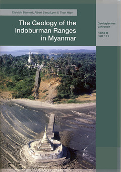
The Geology of the Indoburman Ranges in Myanmar
Auteurs : BANNERT Dietrich, SANG LYEN Albert, HTAY Than

The Indoburman Ranges are the westernmost morphological unit in Myanmar and represent the accretion wedge formed by Late Mesozoic through Paleogene–Neogene geosynclinal sediments with regional transitions into shallow- water sediments with molasse characteristics. The results of the authors' field work from 1974 to 1989, combined with literature searches, form the backbone of the extensive description of the geology of this mountain range.
A total of four geological units contribute to the architecture of the Indoburman Ranges. From west to east they comprise: the Rakhine coastal area with the Ramree–Cheduba Archipelago, the western and central Indoburman Ranges, the eastern Indoburman Ranges and the Innerburman Tertiary Basin.
Most of the rocks are of Paleogene to Neogene age, with regionally distributed units of Upper Cretaceous, Albian and Cenomanian age. Carnian–Norian Triassic flysch is part of the eastern Indoburman Ranges. Jurassic sediments are apparently absent. In the central Chin Hills of the eastern Indoburman Ranges, the epimetamorphic Kanpetlet Schists underwent metamorphism during Upper Cretaceous through Paleocene times (SOCQUET et al. 2002). Originally, the rocks were sedimentated as Triassic flysch. In the Naga Hills, the age of the Naga metamorphic rocks still remains undetermined. The lithological similarity with the Kanpetlet Schists may tentatively suggest a similar age.
Outcrops of numerous serpentinised ultrabasics appear along the boundaries between the tectonic units, especially along the continental splinter of the Western Burma Plate. According to modern models, the whole area is influenced by the docking of the Western Burma Plate onto the Eurasian Plate 83 million years ago (HEINE et al. 2004) followed by the continent-to-continent collision of the Indian Plate with the southern Eurasian Plate.
During the Late Himalayan collision, numerous young strike-slip faults with regional influence appear, which considerably hamper the reconstruction of the original sedimentary regions. The previously assumed nappe tectonic style could not be verified. Tectonic contacts are very steep.
2 - Stratigraphy
. 2.1. Stratigraphy of the Indoburman Ranges
. 2.2. Stratigraphy of the eastern Indoburman Ranges
. 2.3. Stratigraphy of the Western Outcrops of the Innerburman Tertiary Basin
3 - Tectonics
. 3.1. Rakhine
. 3.2. The Chin Hills
. 3.3. The Naga Hills
. 3.4. The Patkoi Ranges
. 3.5. The Kabaw Valley Fault
4 - Plate tectonic development and paleogeographic constraints
5 - References
Map 1: Geological Map of the northern Chin Hills
Map 2: Geological Map of the northern Myanmar and Indian Naga Hills
Ouvrage de 101 p.
Thème de The Geology of the Indoburman Ranges in Myanmar :
Mots-clés :
myanmar - burma - indoburman range - stratigraphy - ophiolite - Triassic- Paleogene - Neogene - plate tectonics
