Lavoisier S.A.S.
14 rue de Provigny
94236 Cachan cedex
FRANCE

Heures d'ouverture 08h30-12h30/13h30-17h30
Tél.: +33 (0)1 47 40 67 00
Fax: +33 (0)1 47 40 67 02


Url canonique : www.lavoisier.fr/livre/agriculture/remote-sensing-in-precision-agriculture/descriptif_4700978
Url courte ou permalien : www.lavoisier.fr/livre/notice.asp?ouvrage=4700978

Remote Sensing in Precision Agriculture Transforming Scientific Advancement into Innovation Earth Observation Series

Langue : Anglais

Coordonnateurs : Lamine Salim, Srivastava Prashant K., Kayad Ahmed, Munoz Arriola Francisco, Pandey Prem Chandra
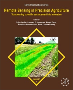
Couverture de l’ouvrage Remote Sensing in Precision Agriculture
Remote Sensing in Precision Agriculture: Transforming Scientific Advancement into Innovation compiles the latest applications of remote sensing in agriculture using spaceborne, airborne and drones? geospatial data. The book presents case studies, new algorithms and the latest methods surrounding crop sown area estimation, determining crop health status, assessment of vegetation dynamics, crop diseases identification, crop yield estimation, soil properties, drone image analysis for crop damage assessment, and other issues in precision agriculture. This book is ideal for those seeking to explore and implement remote sensing in an effective and efficient manner with its compendium of scientifically and technologically sound information.
Section 1. Introduction and Principles of Precision Agriculture
Section 2. PA Practices for soil management
Section 3. PA practices for irrigation water management
Section 4. PA practices for crop management
Section 5. Advanced modelling practices in PA
Section 6. Future Aspects and Challenges in RS for PA
Salim Lamine is a distinguished scientist, serving as a professor and international consultant specializing in remote sensing and precision agriculture. He earned his PhD through a collaborative program between Aberystwyth University in the United Kingdom and the University of Sciences and Technology Houari Boumediene in Algeria. His academic pursuits further extended to the University of Nottingham in the UK, where he delved into GNSS applications, and he gained valuable research experience as an assistant researcher at the University of Aberystwyth. In 2017 Dr. Lamine was honored with the prestigious International Prize for the Environment, “ECOWORLD,” by the Russian Academy of Natural Sciences. He holds mas ter’s degrees from both the Mediterranean Agronomic Institute of Bari in Italy and the Mediterranean Agronomic Institute of Chania in Greece. Currently, he is serving as a member of the editorial board for the prominent Taylor & Francis journal, Geocarto International. Additionally, he extends his expertise as a valued member of the Advisory Panel for several MDPI Journals. Dr. Lamine’s research portfolio encompasses a wide range of multidisciplinary areas, including remote sensing, precision agriculture, hyperspectral imaging, drone-based data analysis, crop yield prediction, field spectroradiometry, water and soil management, agri-biosystems engineering, gis and space mapping, machine learning and SVAT models. Dr. Lamine has made substantial contribu tions to the academic realm, evidenced by over 30 peer-reviewed publications in esteemed journals and participation in more than 150 international confer ences. His scholarly influence also extends to the authorship of several book chapters. He authored a book entitled REMOTE SENSING: Multispectral & Hyperspectral Applications published in 2020.
Prashant K. Srivastava is working at IESD, Banaras Hindu University, as a faculty and was affiliated with Hydrological Sciences, NASA Goddard Space Flight Center, as
  • Presents a well-integrated collection of chapters, with quality, consistency and continuity
  • Provides the latest RS techniques in Precision Agriculture that are addressed by leading experts
  • Includes detailed, yet geographically global case studies that can be easily understood, reproduced or implemented
  • Covers geospatial data, with codes available through shared links

Date de parution :

Ouvrage de 554 p.

19x23.4 cm

Disponible chez l'éditeur (délai d'approvisionnement : 14 jours).

193,44 €

Ajouter au panier

Mots-clés :

?; Active and passive remote sensing; Agriculture; Automated methods for soil mapping and monitoring; Biomass retrieval; Biotic factors; Carbon farming information; Chlorophyll; Climate; Climate change; Colombia; Common Agricultural Policy; Crop condition; Crop damage assessment; Crop management; Crop monitoring; Crop productivity; Crop yields; Decision-making; Digital soil mapping; Disease infestation; Drones; European Commission; FAO; Flavescence doree; Food and fiber; Food security; GEOCARBON; GIS; Geoinformation; Geospatial technology; Geostatistics; Grapevine yellows; Green Revolution; Greenhouse gas; Hyperspectral sensors; In situ data; Internet of things; IoT; IoT data; Irrigation; Kriging; Land suitability; Landsat 8; LiDAR imaging; Machine learning; Microwave SAR; Multispectral imaging; Nonparametric regression; Normalized difference vegetation index; Nutrient management; Optical sensors; Palm oil; Pests; Photosynthetic pigments; Phytosanitary; Plant health; Precision agriculture; Regionalized variable; Remote sensing; Resource use efficiency; Rice; Route planning; Salt-affected soils; Satellite imaging; Seed quality; Semivariogram; Sensor; Sensors; Sentinel-2; Sequestration; Site-specific management zones; Smart farming; Soil condition; Soil management; Soil organic carbon; Soil parameters; Spatial variability; Spectral imaging; Spectral reflectance; Spectroscopy; Sustainability; Thermal imaging; UAV; UAVs; Unmixing; Variability-rate applications; Water quality; WorldView-2; Yield; Yield estimation