Spatial Analysis for Radar Remote Sensing of Tropical Forests SAR Remote Sensing Series
Auteurs : De Grandi Gianfranco D., De Grandi Elsa Carla
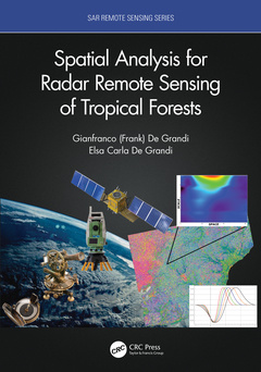
This book is based on the authors? extensive involvement in Synthetic Aperture Radar (SAR) mapping projects, targeting the health of an earth ecosystem with great relevance for climate change studies: the tropical forests. The subject is developed from a vantage point provided by analysis in a combined space, scale (frequency), time, wavelength, polarization domain. The combination of space and scale offers the capability to zoom in and out like a virtual microscope to the resolution in tune with the underlying ecological phenomenon. It also enables statistical measures (correlations) related to the forest spatial distribution in case of backscatter, or to the canopy height variations in case of interferometric observations. The time dimension brings into play measures of the ecosystem dynamics, such as the flooding extent in the swamp forests, deforestation or degradation events. The book?s spotlight is on radar spatial random fields, these being populated by either backscatter observations or elevation data from interferometric SAR. The basic tenet here is that the spatial statistic of the fields measured by the wavelet variance (in stationary or non-stationary situations) carries fingerprints of the forest structure.
Features:
- Uniquely focused on specific techniques that provide multi-resolution spatial and temporal analysis of forest structure characteristics and changes
- Examines several large and important international remote sensing projects aimed at documenting entire tropical ecosystems
- Provides novel wavelet methods for tropical forest structural measures
- Includes Python code for a suite of wavelet based time-series and single set InSAR coherence and backscatter speckle filters, available to download
As the first book on this topic, this composite approach appeals to both students learning through important case studies and to researchers finding new ideas for future studies.
PART I - SARCHEOLOGY: The Era of the big Radar Mosaics.
The Dawn of The Radar Mosaics Era: The ESA-JRC Central Africa Mosaic Project. The L-Band Breed: The GRFM Africa Radar Mosaic. The CAMP-GRFM Thematic Products. Evolution of The Species: The ALOS PALSAR Africa Mosaic.
PART II - Measures of SAR Random Fields in the Scale-Space-Time Domain.
The Stuff Backscatter Random Fields are Made of. Statistical Measures of SAR Random Spatial Fields: Fingerprints of Forest Structure. Hitting Corners: The Lipschitz Regularity, a Measure of Discontinuities in Radar Images Connected with Forest Spatial Distribution. The Beauty Farm: A Wavelet Method for Edge Preserving Piece-Wise Smooth Approximations Of Radar Images. The Cleaning Service: A Multi-Temporal Insar Coherence Magnitude Filter. Proxies of Forest Volume Loss and Gain by Differencing Insar Dsms: Fingerprints Of Forest Disturbance.
Gianfranco (Frank) De Grandi received a doctorate degree in Physics Engineering with honors from the Politecnico Milano, Italy, in 1973. He later joined the European Commission Joint Research Center, Ispra, Italy, where he has performed research in signal processing for application areas such as gamma ray spectroscopy, data communications, and radar remote sensing. From 1986 to 1989 he headed the signal processing section of the Electronics Division, JRC, where he introduced VLSI design technology and conducted research, in cooperation with Bellcore, on packet video, and in cooperation with ITALTEL Italy on the European digital mobile phone network. In 1989 he joined the JRC Institute for Remote Sensing Applications, where he started his research activity in radar remote sensing for earth observations, and in particular in SAR polarimetry. From 1997 to 2001 he has served as assistant professor with the Faculte' de Feresterie et Geomatique, Universite' Laval, Quebec, PQ, Canada. He retired from active service at the European Commission in 2012. He continued through 2017 his activity in science and education as a visiting scholar at the University of Wales at Aberystwyth, Ceredigion, UK. Dr. De Grandi collaborated with several laboratories in the US, such as Lawrence Livermore National Lab, and Los Alamos National Lab for nuclear safeguards, Caltech Jet Propulsion Laboratory and the US Naval Research Lab for radar remote sensing. At the EC Joint Research Center (JRC) he was team leader of the Central Africa Mosaic Project (CAMP), a joint initiative of the JRC and the European Space Agency (ESA), which for the first time produced a regional scale high resolution radar map of Central Africa. He was principal investigator with the Japan Aerospace Exploration Agency (JAXA) Global Rain Forest Mapping and Global Boreal Forest Mapping projects, of the JAXA EORC Kyoto & Carbon Initiative for ALOS PALSAR. He was an international collaborator in a NASA Carbon Cyc
Date de parution : 05-2023
17.8x25.4 cm
Date de parution : 03-2021
17.8x25.4 cm
Thèmes de Spatial Analysis for Radar Remote Sensing of Tropical... :
Mots-clés :
Interferometry; Synthetic Aperture Radar (SAR); SAR; Interferometric SAR; LIDAR; Radar Mosaic; Wavelet Representation; Tropical Forest; Scattering Model; Texture; Synthetic Aperture Radar; Spatial analysis; Remote sensing; Tropical forests; InSAR Coherence; PALSAR Image; Real SAR Image; Object Based Change Detection; SAR Backscatter; InSAR Observation; Co-polar Channels; Plane Parallel Medium; HH Ratio; Coherence Magnitude; Real SAR Data; Backscattering Coefficient; Wavelet Variance; Wavelet Coefficients; Wavelet Transform; SAR Image; Radar Cross-section; SRTM DEM; Wavelet Maxima; RGB Composite; RGB Channel; VGT Data; LRF; Wavelet Covariance; Sf